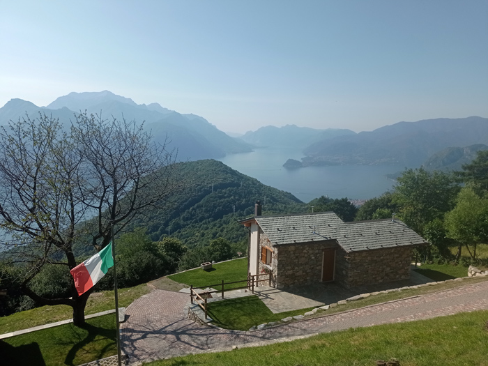
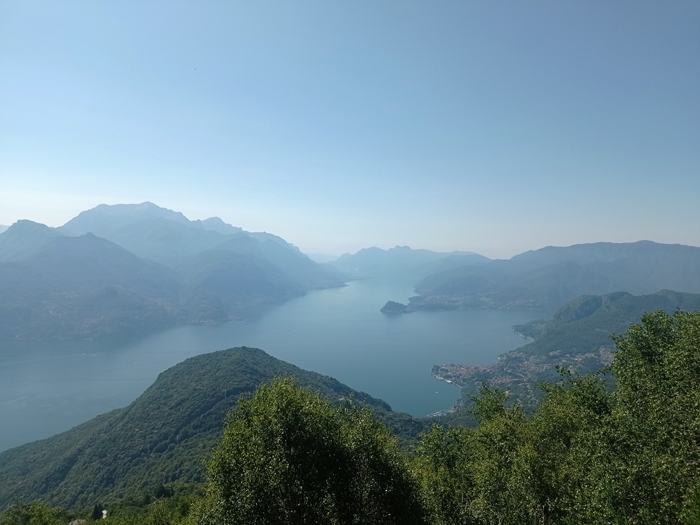
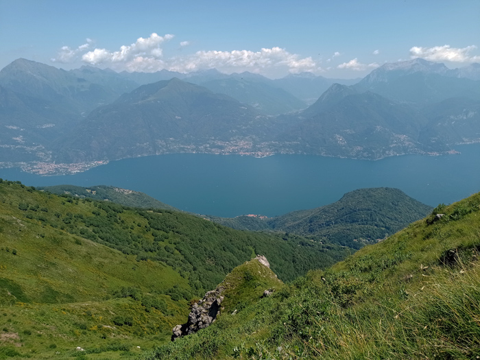
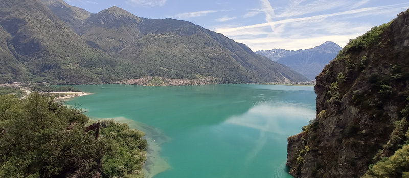
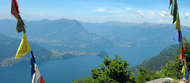
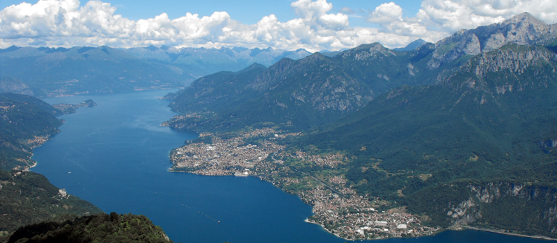
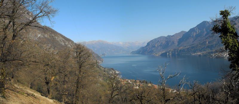
Mount Grona (1736 m - Plesio) rises on the western shore of Lake Como, with its rocky spurs dominating Menaggio and marks the eastern border of the Lugano Pre-Alps. The view from the summit of Mount Grona is incredible: to the east is the center of Lake Como with the Grigne group, to the south Bellagio and the mountains of the Lariano Triangle, while to the west Lake Piano and the Ceresio. This excursion requires excellent training as in some places youll have to help yourself with your hands to overcome short rocky sections however in particularly exposed passages there are fitted ropes, so we recommend caution and suitable shoes. You can reach Breglia starting from Menaggio by bus (C13 - ASF Autolinee), next to the church of San Gregorio (750 m - Breglia), there are also free parking spaces.
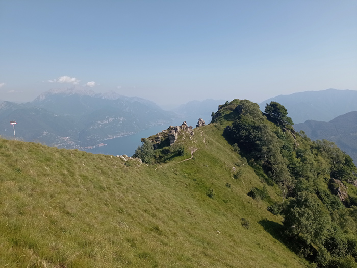
From Breglia begin the ascent by taking the Via ai Monti, along the way some signs will indicate shortcuts where it is possible to cut the hairpin bends by going through the woods, skirt around the beautiful huts and without spending too much effort youll reach the paid parking spaces of the Monti di Breglia (1080 m). Continue the climb on the Sentiero Alto immersed in a forest of beech and birch trees. After passing a beautiful panoramic point, follow the signs for S.Amate and M.Bregagno, youll begin to feel the slopes but the magnificent views will make up for your every effort. Beyond a soft hump, the valley of the Serio stream opens up in front of you and youll begin to see the Rescascia mountain pasture and Mount Bregagnigno. After having walked a splendid stretch halfway up the hillside youll then arrive at the Sant'Amate oratory (1623 m).
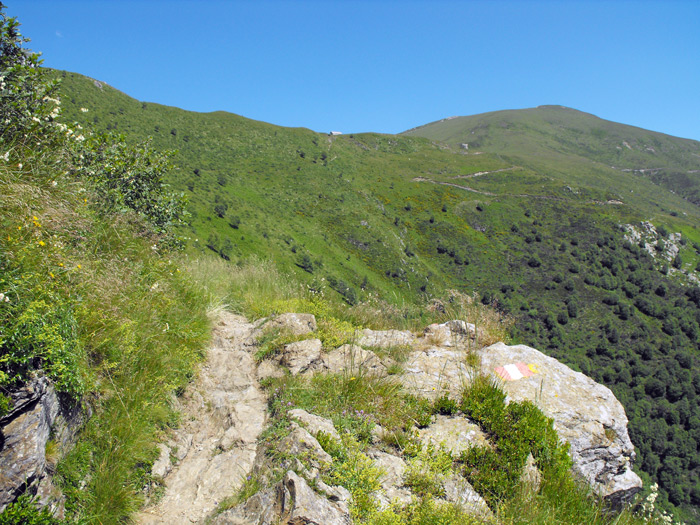
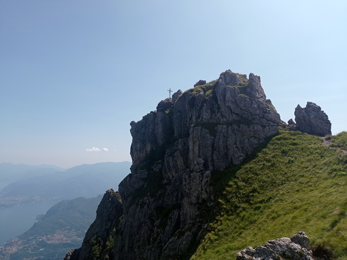
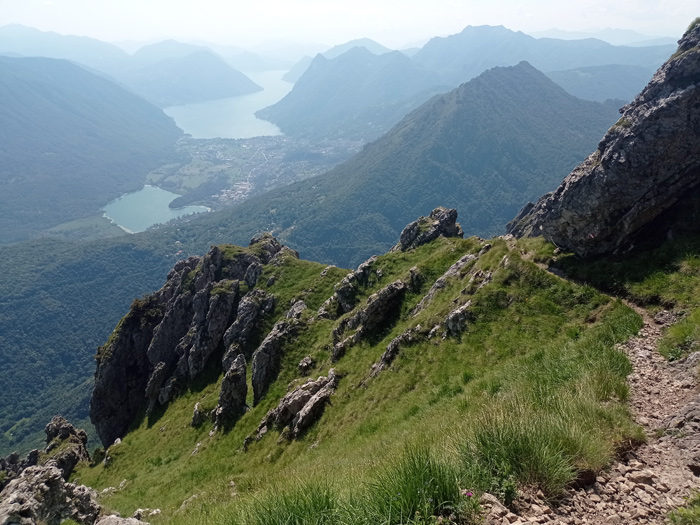
In Sant'Amate follow the signs for Mount Grona, once you reach Forcoletta (1610 m) we advise those who are not familiar with rocks and exposed stretches to descend to the Menaggio refuge, as from here on the paths are for expert hikers only. Continue the climb following the signs on the rocks and in a short time you shall arrive at the foot of the rocky spur where the cross of Mount Grona (1736 m) stands, with the help of fitted ropes youll reach the summit. After a break, start the descent along the panoramic path, the track is always clearly visible but the slopes are not to be underestimated. Arriving at Pizzo Coppa (1425 m) proceed down a slight slope to the Menaggio refuge (1383 m). After a refreshment, descend on the Sentiero Basso to the Monti car park and return to Breglia following the road you previously travelled.

The Sentiero del Viandante travels halfway up the eastern part of Lake Como, beginning in Abbadia and ending in Morbegno. To allow you to enjoy this these beautiful sites in total tranquility, the route is divided into six stages.
Sentiero del Viandante
The hike on the Strada Regia is not particularly difficult, and is instead easily doable at any time of the year, keeping in mind to avoid the hottest days of summer and snow in winter. In this guide we have divided the route into three stages.
Strada Regia
The trek to the ridge of the Lariano Triangle kicks off from Brunate and ends in Bellagio, the growth is about 37 km. which corresponds to 8/10 hours of walking, with some variations it is also possible to make the route with MTB.
Ridge Lariano Triangle