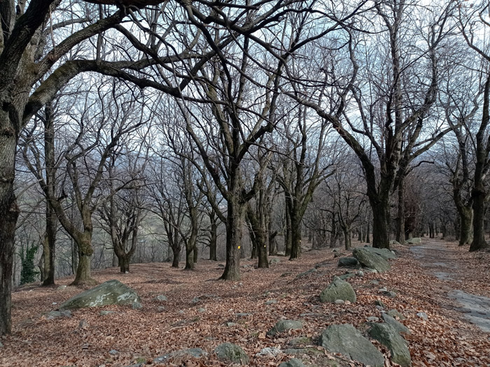
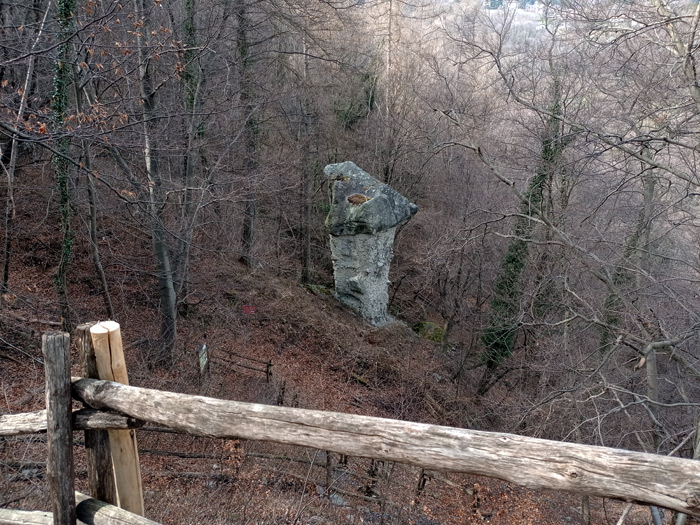
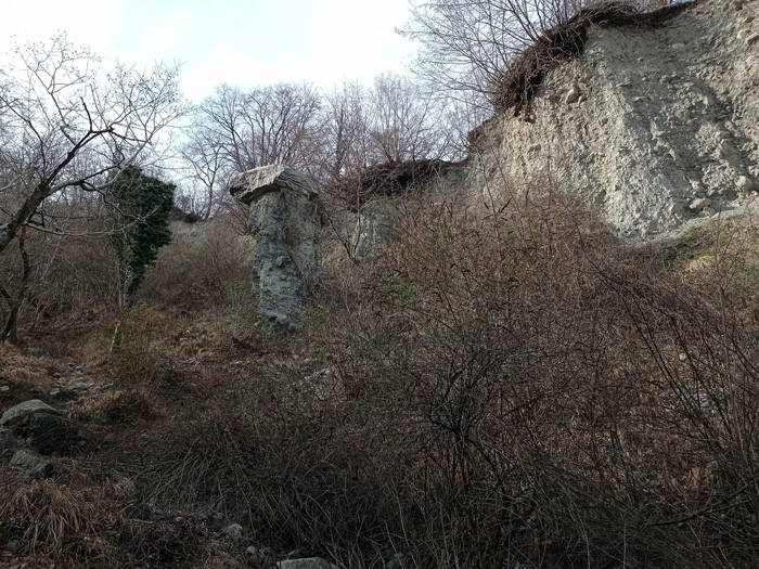
Excursion of geological and naturalistic interest through the woods of the Lariano Triangle in search of chestnuts, erratic boulders and the earth mushrooms of Rezzago. Earth mushrooms (erosion pyramids) are columns of moraine earth (gravel and clay) topped by a large stone that compacts and protects the underside from rainwater erosion. The route crosses the Selva Castanile di Enco (840 m), a beautiful chestnut grove where in autumn it is possible to collect chestnuts in compliance with the municipal provisions. We recommend using the FNM railway stations of Caslino d'Erba and Asso Canzo to reach this beautiful walk and let's not forget that youll be needing: a good supply of water, food and hiking shoes.
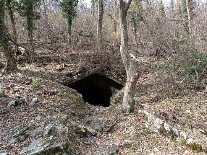
From the station of Caslino d'Erba youll cross the provincial road and begin to climb up between the houses of the village, skirting the town hall and walking along Via Monte Palanzone next to the Piot stream. After crossing the Vallunga bridge you will arrive at the Franciscan Forum, where youll find valuable votive shrines dedicated to the life and works of the Saint of Assisi. At the Forum follow the path on the right that leads into the woods, pass the cross that overlooks the religious complex and shortly after you shall arrive at the Boldrino cave (750 m). After a gentle climb halfway up the hillside and passing two deep valleys youll arrive at Pian di Cupiàna (900 m). At Bocchetta di Vallunga (905 m) turn right and begin the descent towards Enco.
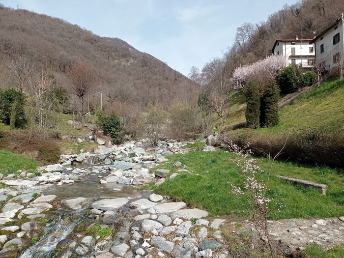
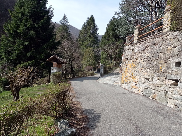
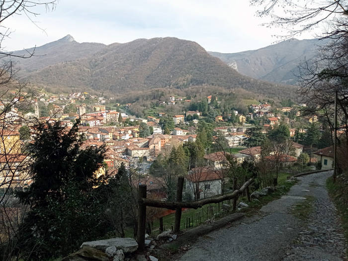
When the path becomes a paved road youll enter the Selva di Enco, probably the most beautiful and well-kept chestnut forest in the Lariano Triangle. At the end of the descent turn right and after a few steps look for the sign (detour to the left) to reach mushroom no. 1, following the itinerary with caution, youll have a possibility of seeing two mushrooms formed and a third in the embryonic stage. Continue the descent to the church of Buona Morte (610 m), where youll find a huge erratic boulder and a well-equipped rest area. Once at the Rezzago bridge turn right, climb up a steep ramp and after having traveled a long stretch on a false plain youll begin the descent towards Asso. At the bridge over the Lambro river turn right following Via Lazzareto and when you reach the church of Saints Giovanni & Paolo continue to the Asso Canzo railway station.

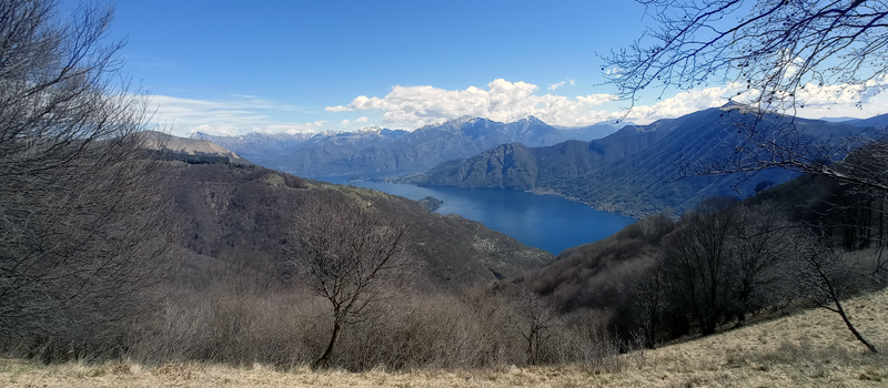
The Sentiero del Viandante travels halfway up the eastern part of Lake Como, beginning in Abbadia and ending in Morbegno. To allow you to enjoy this these beautiful sites in total tranquility, the route is divided into six stages.
Sentiero del Viandante
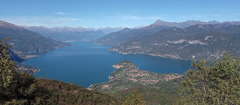
The hike on the Strada Regia is not particularly difficult, and is instead easily doable at any time of the year, keeping in mind to avoid the hottest days of summer and snow in winter. In this guide we have divided the route into three stages.
Strada Regia
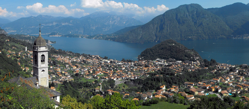
The trek to the ridge of the Lariano Triangle kicks off from Brunate and ends in Bellagio, the growth is about 37 km. which corresponds to 8/10 hours of walking, with some variations it is also possible to make the route with MTB.
Ridge Lariano Triangle