Panoramic excursion that, starting from Olcio (250 m), reaches the Zucco Sileggio (1373 m), descending then from Era di Sopra (1030 m) to the Sanctuary of Santa Maria (661 m) and coming back to the starting path on the via ai Saioli. The trekking requires good training since the climb has considerable slopes, and at some points you’ll have to help yourself with your hands to overcome short rocky stretches. The paths are well marked (CAI Grigne) with yellow and blue markings that we can find in the woods, but we recommend: caution, mountain shoes, a supply of water and be sure to postpone the trip in case of bad weather. We can arrange the departure at the railway station of Olcio (Trenord) where hourly trains pass that go on to Lecco and Sondrio.
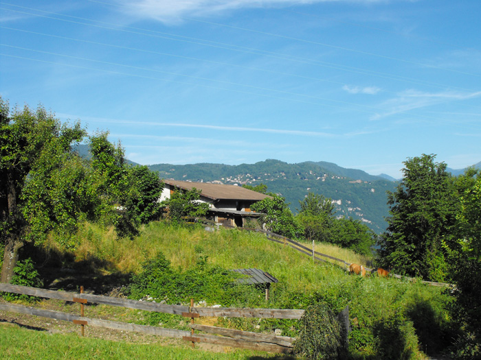
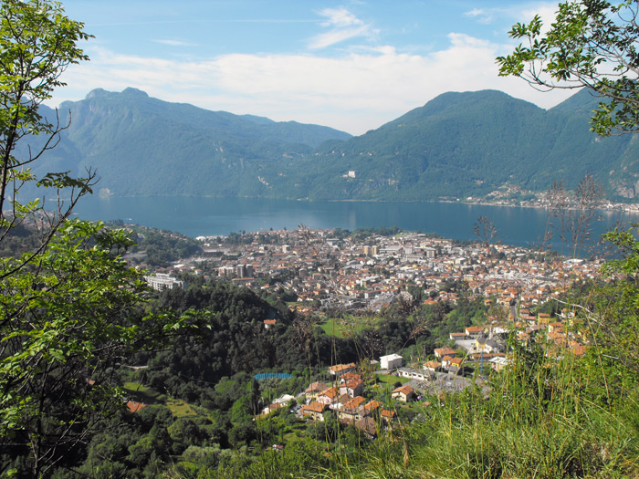
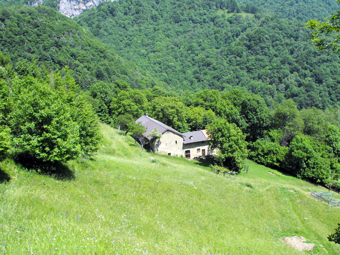
From the railway station we cross the village of Olcio by marching upstream, following the path that climbs to the cemetery of Somana. Upon reaching via ai Saioli, we’ll continue along the dirt road next to the temple. After passing the aqueduct in the middle of a hairpin bend, we’ll find the junction (left turn) for path 17A, where the mule track climbs steeply into the woods and where we can take advantage of some beautiful views of Mandello Lario to catch our breath. After a small hut we’ll leave the woods and pass through a clearing with a splendid view of Bellagio, continuing after a short stop to climb into a forest of beech and birch trees.
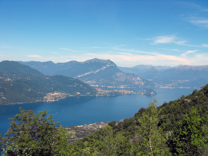
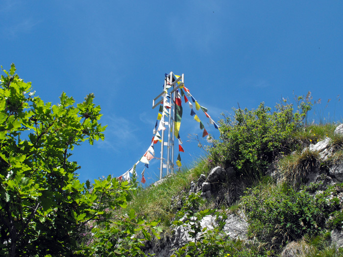
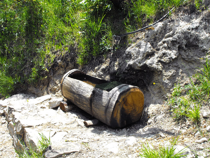
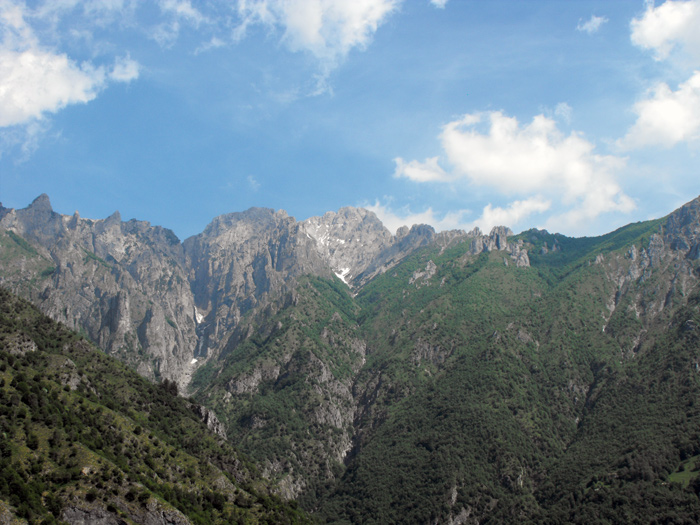
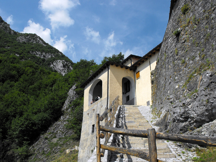
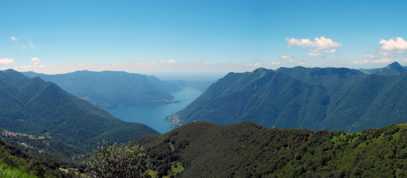
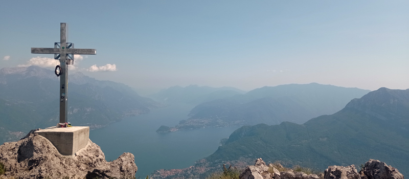
Near a ruin we find the indication to the right for the "Sileggio Direct", and then we’ll go along up the coast, and afterwards there is a bend to the left where we’ll carefully climb a rocky spur to finally reach the cross on the Zucco Sileggio. The view from the belvedere is incredible: to the north-west we can admire the central part of the Lario while to the south-east the Grigne mountains. We continue our journey along the Mario Sforza bivouac shelter (1360 m), going down to the Verdascia pass (1243 m) and turning right towards Alpe d'Era. After a steep descent, we’ll leave the woods with a view of the huts of Era di Sopra (980 m) where we find the signs (turning to the right) for path 17. When the slopes begin to ease a bit we reach a fortuitous spring, and we’ll go down to the Sanctuary of Santa Maria (661 m) and after the chapel of Santa Preda (580 m) we’ll follow the dirt road that takes us back to via ai Saioli (390 m) and to the path for Olcio.

The Sentiero del Viandante travels halfway up the eastern part of Lake Como, beginning in Abbadia and ending in Morbegno. To allow you to enjoy this these beautiful sites in total tranquility, the route is divided into six stages.
Sentiero del Viandante
The hike on the Strada Regia is not particularly difficult, and is instead easily doable at any time of the year, keeping in mind to avoid the hottest days of summer and snow in winter. In this guide we have divided the route into three stages.
Strada Regia
The trek to the ridge of the Lariano Triangle kicks off from Brunate and ends in Bellagio, the growth is about 37 km. which corresponds to 8/10 hours of walking, with some variations it is also possible to make the route with MTB.
Ridge Lariano Triangle