Mountain Refuges and Base Camps of Mount Resegone
Rifugio A. Stoppani – 890 m (2,920 ft)
Located in Val Comera on the scenic slopes of Mount Resegone, this refuge sits just above the traditional stone cottages of Costa. Completely rebuilt in 1978, it features a welcoming dining hall for packed lunches, full restaurant service, and 22 beds on the upper floor. Season: Open daily from mid-June to mid-September; open Wednesdays, Saturdays, and Sundays the rest of the year. Tel: +39 0341 491517 | Beds: 22
Rifugio L. Azzoni – 1,860 m (6,100 ft)
This refuge boasts a spectacular panoramic position just a few meters below Punta Cermenati, the highest peak of the Resegone. It serves as the primary meeting point for all summit trails. The hut offers 15 beds and is open daily in July and August, and on weekends and holidays throughout the rest of the year. Adjacent to the refuge is the Città di Lecco emergency bivouac, which is always open, equipped with a heater and blankets, and can accommodate 10–12 people. Tel: +39 333 3144987 | Beds: 15
Passo di Valbona (Culmine di San Pietro) – 1,258 m (4,127 ft)
This high mountain pass marks the natural divide between the Resegone and Campelli groups. It is a strategic base for various traverses and climbs toward Mount Due Mani and the Muschiada peaks. The area features two hotels, typically open from June through September and during holidays in the off-season.
Morterone – 1,070 m (3,510 ft)
Known as the smallest and most secluded municipality in Italy, Morterone consists of a central village and several tiny historic hamlets. The village offers an inn with lodging and is connected to Ballabio by a winding mountain road. It is an ideal starting point for ascents to Mount Resegone and Mount Due Mani, as well as several scenic cross-country routes. The area also features small-scale skiing facilities.

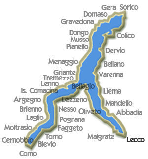
Lecco Lake Como
 Malgrate - Mount Barro
Elev: 750 m / 2,460 ft ↑
 Onno - Mount Megna
Elev: 980 m / 3,215 ft ↑
 Corni di Canzo Loop
Elev: 940 m / 3,080 ft ↑
 Zucco di Sileggio Loop
Elev: 1,180 m / 3,870 ft ↑
View All Lake Como Hikes